

The Rennsteig was a messenger route even back in the Middle Ages. In the days of the German Empire it was the most travelled long-distance hiking trail and a symbol of German unity. The Rennsteig ridgeway trail has more popular associations than any other hiking trail and has certainly crossed more borders than any other.
Back in the 19th century, hikers walking the whole of its 168 kilometres passed through well over a dozen small states. For 73 kilometres the Rennsteig itself formed a border; the remaining 95 kilometres ran through a patchwork of different principalities. It was once known as a monument to German sectionalism and was marked by more than 1,300 boundary stones bearing the coats of arms of often tiny states. "No mountains in the world have anything to match the ancient Rennsteig“, enthused August Trinius, the "father of the Rennsteig", in his 1890 book, which triggered a boom in the Rennsteig's popularity.
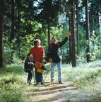
From the middle reaches of the river Werra - or rather from Hörschel (near Eisenach) - to the upper reaches of the river Saale near Blankenstein, the Rennsteig runs across the peaks of the Thuringian Forest and the Thuringian Slate Mountains as far as the northern Franconian Forest. It is like walking on top of the world - the stuff of hikers' dreams. The Rennsteig is an ancient border path that has acquired almost mythical status. Still held in awe by many, it opens up stunning natural vistas of beauty and romance.
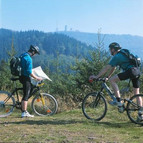
The cycle path that runs parallel to the Rennsteig trail also offers glorious views of the scenery and leads to places with a wealth of history. The first 30 kilometres (Eisenach) and the final 15 kilometres (Blankenheim) have the greatest differences in altitude and are excellent for mountain bikers with high levels of fitness. The Rennsteig reaches its highest points between Oberhof and the Schmücke beauty spot: the summits of Mount Beerberg (982 metres) and Mount Schneekopf (978 metres).


